Andy Wilson, Regional Director for Ordnance Survey in Africa
Africa as a continent contributes the least to greenhouse gas emissions, yet is already seeing the consequences of climate change. The impact on resources will challenge African nations at a time of immense growth, and policymakers must use all tools at their disposal to advocate for its people.
African countries face unparalleled challenges when it comes to climate change. While African nations are responsible for only 4% of global carbon emissions, the continent is set to be among the first to experience the most devastating impacts of climate change. Climate change also acts as a risk multiplier, increasing the chance of local and regional conflict by putting pressure on resources, land use and job security.
Extreme weather events, drought and famine, deforestation and desertification are all pressing climate issues that impact African nations in unique ways. Extreme weather and flooding are likely to become more common as the 21st century progresses – 2019’s Cyclone Idai displaced thousands, put pressure on food security, and caused death and destruction across southern Africa. It’s estimated that the damage already caused by climate change across Africa could go into the trillions of dollars.
Addressing the climate emergency will involve both adaptation and mitigation. Many African countries have ambitious goals for reducing climate change impact, which include substantial emissions reductions by 2030 as part of the National Determined Contributions (NDCs) at the heart of the Paris Climate Agreement. At COP26 in November, South Africa – one of the top coal producers in the world – received a pledge of $8.5 billion USD to transition to renewable energy. Yet according to the African Development Bank, financial promises from the richest nations in attendance at COP26 fall well short of past and current requirements to support Africa’s climate change resilience – estimated at $1.3 trillion USD.
The pressure of population growth
While many countries in the world are experiencing population decline, we are seeing African nations garner the fastest population growth across the globe as their development and urbanisation gathers pace. The continent’s population is growing at 2.7% a year, which is more than twice as fast as South Asia and Latin America. Given current rates, Africa’s inhabitants are set to double by 2050.
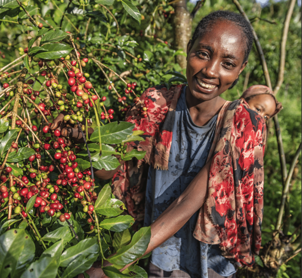
This presents particular challenges for African countries for honoring NDCs and lowering emissions, as they must attempt to decrease carbon output while demand for resources rises. Food production in Africa must dramatically increase yet the conditions for growing that food are becoming more unpredictable. Climate related risks, including increased extreme weather events, also pose a great threat to food security as they can increase the risk of crop failure. With 96% of African agriculture dependent on rainfall and 50% of fisheries related jobs estimated to be lost by 2050, climate change also poses a very serious threat to livelihoods.
A data solution to understanding land
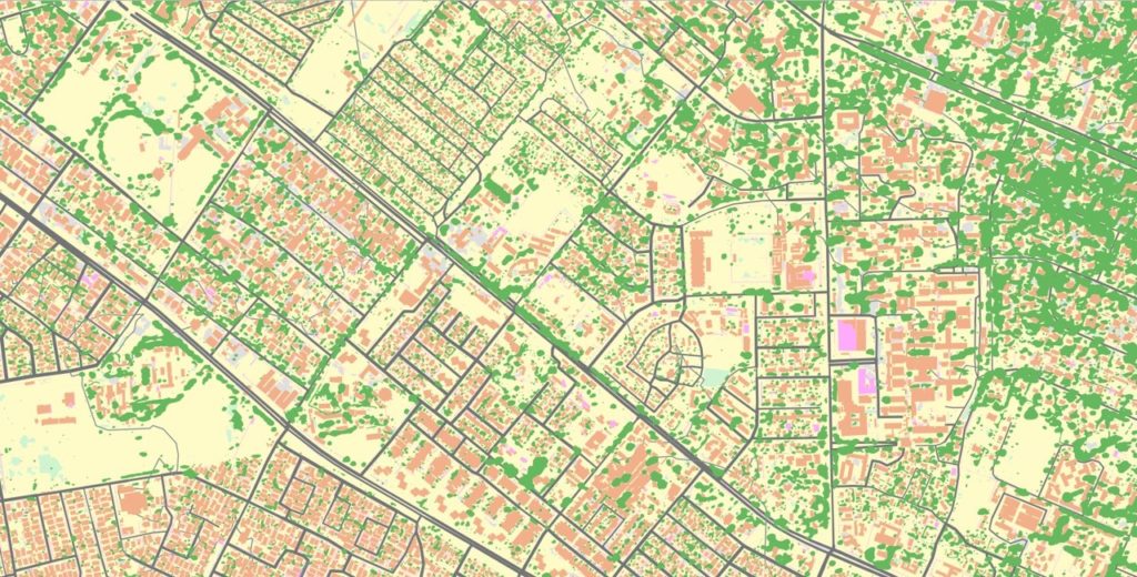
Instead of treading the same technological path as the biggest carbon emitting countries, African countries have the opportunity to develop more sustainably, ‘leapfrogging’ legacy energy infrastructure and in many regions adopting more advanced, sustainable options. The UN’s 2030 Agenda including the Sustainable Development Goals (SDGs) provide a framework for development that takes into account environmental and sustainability issues, providing African countries with a viable route to a sustainable future. Geospatial data plays a particularly important role in implementing the SDGs and measuring progress against them, helping to model the environmental impact of infrastructure projects and inform decision making. Geographic Information Systems (GIS) in agriculture can help farmers to achieve increased production and reduced costs by enabling better management of land resources.
Environmental degradation, including desertification and deforestation, is happening at a startling pace in Africa, and geospatial data is a vital tool for monitoring, predicting and preventing it. The Department of Rural Economy and Agriculture (DREA) of the African Union has identified enhancing access to environmental information, including Earth observation data, as a priority in its environmental agenda. Africa’s rainforests are more resilient as carbon sinks than those elsewhere, even when exposed to high temperatures, yet deforestation is a major threat to such assets, with around 25% of all global greenhouse gas emissions coming from deforestation and other land-use changes. Emissions from tropical deforestation are equal to the emissions from the whole of the EU, and monitoring and preventing deforestation is one of the most effective ways to cut carbon emissions and mitigate climate change.
Geospatial tools can help nations to manage this increased risk to the country’s resources, and predict crop failure and drought. Digital basemaps can now be built quickly and cheaply using automation and satellite imagery, with Earth observation data collected over many years providing information on land use, water availability and soil type to give you analytic and predictive power to boost your food security.
Tracking changing cities
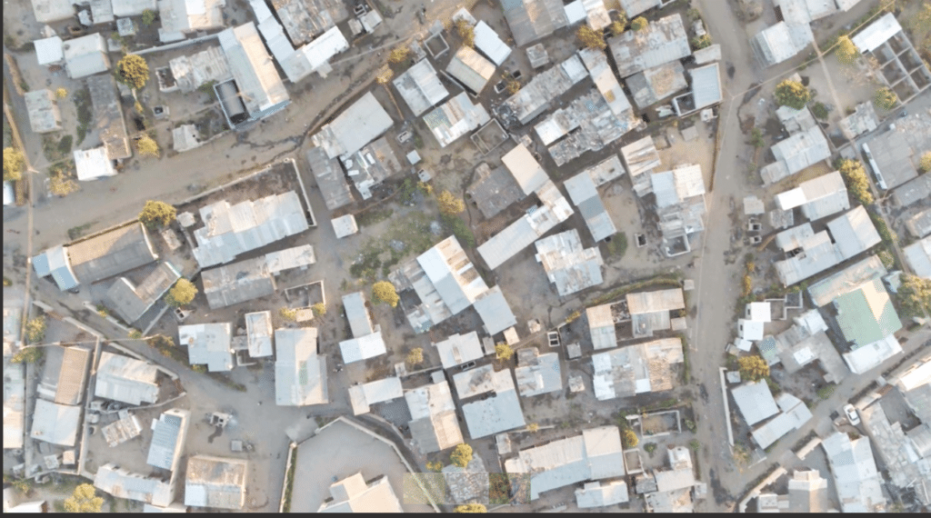
Thanks to technological innovation, it is easier than ever before to maximise the value of location data and build your geospatial capabilities. Geospatial innovation is accelerating at great speed, and it is now possible to build a digital base map in a fraction of the time and for a fraction of the cost of mapping efforts in the 20th century. Recently, a collaboration between Ordnance Survey, the International Growth Centre (IGC) and the Commonwealth Association of Architects (CAA) was established to respond to the issue of insufficient spatial data, by piloting the creation of an automated base map of Lusaka in Zambia – in this case in response to the challenge of recognising informal settlements in the city, many of which are vulnerable to environmental impact and devoid of effective infrastructure to manage disasters such as drought. Using aerial imagery of Lusaka, Ordnance Survey generated a new base map using its advanced automated process which is faster and more resource efficient than traditional methods. The geospatial data is now available to the Zambian Government, helping policy makers to inform critical infrastructure, deciding where to locate public services, sanitation, and healthcare.
Africa has contributed the least to climate change, and yet the continent may well experience its most severe consequences. This means that African nations must adapt quickly to a riskier world, with geospatial data and technology providing the intelligence to tackle challenges head on.
Using the power of geospatial data, African nations have the opportunity to become trailblazers in adapting to a changing climate, while prioritising sustainability and reducing emissions. Digital base maps can be thought of as a foundational technology that enables nations to launch a green economy.
It is now easier and quicker than ever to build your own geospatial data capabilities. By working with Ordnance Survey, you can combine 200 years of mapping expertise with the speed and usability of modern technological innovation, to deliver bespoke solutions to help your nation develop sustainably, measure progress against Sustainable Development Goals, reduce emissions and manage risk associated with climate change.
With next year’s UN climate conference returning to Africa, nations can come to the table with more information at their hands than ever before about how Africa can be at the forefront of tackling this greatest of challenges.
Read our report on ensuring your country is sustainable, resilient and prepared against environmental challenges with geospatial data.
DISCLAIMER: Brand Voice is a paid program. Articles appearing in this section have been commercially supported.